published in Nature, Scientific Report
Nature, Scientific Reports volume 13, Article number: 4090 (2023) Cite this article
Abstract
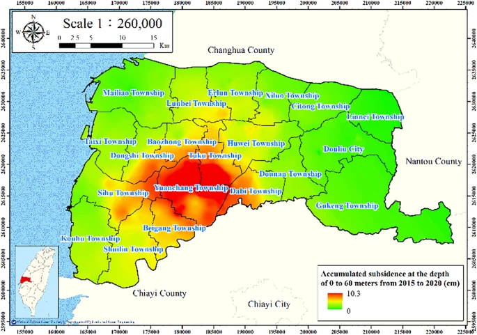
In this study, the land subsidence in Yunlin County, Taiwan, was modeled using an artificial neural network (ANN). Maps of the fine-grained soil percentage, average maximum drainage path length, agricultural land use percentage, electricity consumption of wells, and accumulated land subsidence depth were produced through geographic information system spatial analysis for 5607 cells in the study area. An ANN model based on a backpropagation neural network was developed to predict the accumulated land subsidence depth. A comparison of the model predictions with ground-truth leveling survey data indicated that the developed model had high accuracy. Moreover, the developed model was used to investigate the relationship of electricity consumption reduction with reductions in the total area of land with severe subsidence (> 4 cm per year); the relationship was approximately linear. In particular, the optimal results were obtained when decreasing the electricity consumption from 80 to 70% of the current value, with the area of severe land subsidence decreasing by 13.66%.
Abstract: https://doi.org/10.1038/s41598-023-31390-5
PDF Version: https://www.nature.com/articles/s41598-023-31390-5.pdf?pdf=button%20sticky